RETOUR
return / zurück

 
Escalade
Rock-climbing / Klettern
      english   Translation at the end of the page.             
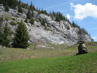
La Falaise du Col des Glières

Cette falaise se trouve à 50m du Chalet du Collet.
Il y a 15 voies allant d'un niveau débutant à un niveau moyen:
niveau 3/4 : 2 voies, niv.5 : 2 voies, niv.6 : 7 voies, niv.7 : 4 voies.
Hauteur : 15m
Rocher : calcaire, orientation : sud
Période : mai à octobre
La Falaise du Col des GlièresFalaise des Glières
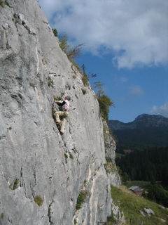
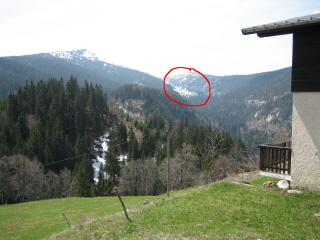
L'Ablon depuis le chaletLa falaise d'Ablon

L'Ablon


Le site majeur de la Haute-Savoie par l'ampleur de la falaise,
la qualité des lignes et le cadre. Le Rocher est compact et finement ciselé, les voies sont à peu près verticales.
Avec 239 voies,  il fait la joie de tout escaladeur :
niv.3/4 : 6 voies, niv.5 : 12 voies, niv.6 : 119 voies, niv.7 : 91 voies, niv.8 : 11 voies.
Hauteur : 15 à 40m
Rocher : calcaire, orientation : sud-est
Période : juin à octobre
 
Depuis le Chalet du Collet, il faut compter environs 1h 1/2 de marche.
On peut gagner un peu de temps ( 30 min.) en prenant la voiture jusqu'au parking du chemin vers l'Ablon.
D'ailleurs, on a une trés belle vue sur l'Ablon depuis le Chalet.
 
La Pierre Taillée

A 1,5 km de Thorens-Glières, en direction du Plateau.
Un grand mur proche de la verticale plutôt légèrement déversant.
Les voies sont longues ( 30m ) sur un beau rocher adhérant et sculpté.
32 voies : niv.3/4 : 3 voies, niv.5 : 6 voies, niv.6 : 8 voies, niv.7 : 13 voies, niv.8 : 2 voies.
Hauteur : 15 à 35m
Rocher : calcaire, orientation : ouest, sud-ouest

Accès : A 1,5 km de Thorens-Glières en direction du col des Glières, 
800 m après le lieu-dit Sales, se garer à gauche sur un petit parking. 
Partir sur le large chemin direction "circuit de Pierre Taillée les Cheneviers" 
(petit panneau "Falaise de Pierre Taillée") et assez rapidement prendre une
petite sente à droite (balisage jaune et rouge, deuxième petit panneau "Pierre Taillée") qui serpente dans la forêt à droite du large chemin. On arrive à une bifurcation.

- Secteur principal : prendre la sente de droite (3ème petit panneau ; 
Si on continue tout droit, on récupère le large chemin). 
Un peu plus loin, en contrebas de la falaise, au niveau d'un arbre avec inscription
"M.M", prendre à gauche.

- Secteur PTT : prendre la sente de gauche. Un peu plus loin, 
ne pas rejoindre le large sentier (on peut aussi le suivre pour arriver 
plus directement ici) mais continuer tout droit pendant 5 à 10 minutes
(balisage bleu) puis horizontalement à droite juste avant la falaise.

(source: www.escalade-74.com)


Pierre Taillée

( source: www.escalade-74.com )
Vous trouvez les topos sur
'40 falaises Annecy'
Prix: 33 €
Auteur: Robert Durieux
Editeur: Compte d'Auteur

Voici un site internet qui peut vous donner plus d'infos:  http://www.escalade-74.com

Pour s'initier ou perfectionner à l'escalade avec un moniteur Brevet d'Etat contactez :
Iliana PEIKOVA
06.79.37.25.80
terre.escalade@gmail.com
 http://terre-escalade.com/

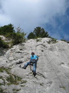
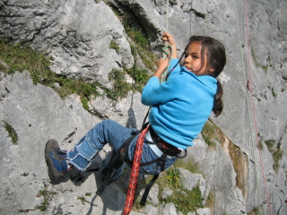
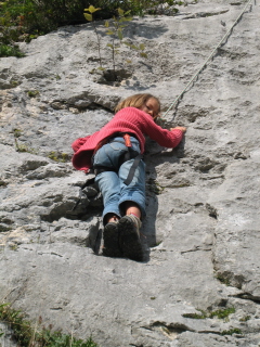
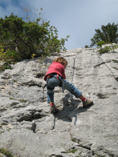
Et nous aussi, on s'y est mis:
escalade 1 escalade 2 escalade 3 escalade 4 escalade 5 escalade 6


english

Rock-climbing

The Col des Glières cliff
This cliff is located 50 minutes from the Chalet du Collet. There are 15 routes ranging from beginner level to average level. Level 3/4, 2 routes; level 5, 2 routes; level 6, 7 routes; level 7, 4 routes.m Height : 15m. Rock : limestone, facing south.
Period of use : May to October.

Ablon cliff
The main rock-climbing site in Haute-Savoie, with a vast rock face, quality routes and a beautiful setting. The rock is compact and finely chiselled, and the routes practically vertical. 239 routes. Level 3/4, 6 routes; level 5, 12 routes; level 6, 119 routes; level 7, 91 routes; level 8, 11 routes.
Height : 15 to 40 m. Rock : limestone, facing south-east. Period of use : June to October.
This rockface can be seen from the Chalet du Collet and is located about an hour and a half’s walk away, but you can save time (30 minutes).by driving to the car park near Ablon.


La Pierre Taillée cliff

Located 1.5 km from the village of Thorens-Glières, in the direction of the Plateau des Glières.
A large rockface which is practically vertical, and juts out slightly. Long routes (30m) on sculptured rock with good grips.Level 3/4, 3 routes; level 5, 6 routes; level 6, 8 routes; level 7, 13 routes; level 8, 2 routes. Height : 15 to 35m. Rock : limestone, facing west, south-west.
Access : Located 1.5 km from the village of Thorens-Glières, in the direction of the Plateau des Glières. 800m after the small hamlet of Sales park in a small car park on the left. Take the wide footpath marked “Circuit de Pierre Taillée/les Cheneviers” (a small signpost is marked “Falaise de Pierre Taillée”) then, shortly afterwards, a small path on the right (yellow and red paint, and second sign “Pierre Taillée”) which winds up into the forest to the right of the wide path, to reach a fork.

For the main part of the cliff : at the fork, take the right-hand path (third sign “Pierre Taillée”. If you go straight on you reach the wide path.) A little further, at the foot of the rockface, next to a tree marked “MM”, turn left.
For the PTT part of the cliff : at the fork, take the left-hand path. A little further, don’t go on the wide path, continue straight on for 5 to 10 minutes (blue paint) then horizontally to the right just before the cliff.

 Information from : http://www.escalade-74.com

You can also get further details about the routes from the book ‘28 Falaises autour d’Annecy’, €30, by Robert Durieux, published by Compte d’Auteur.